El Niño 2026–2027: The Global Map of Climate Risks
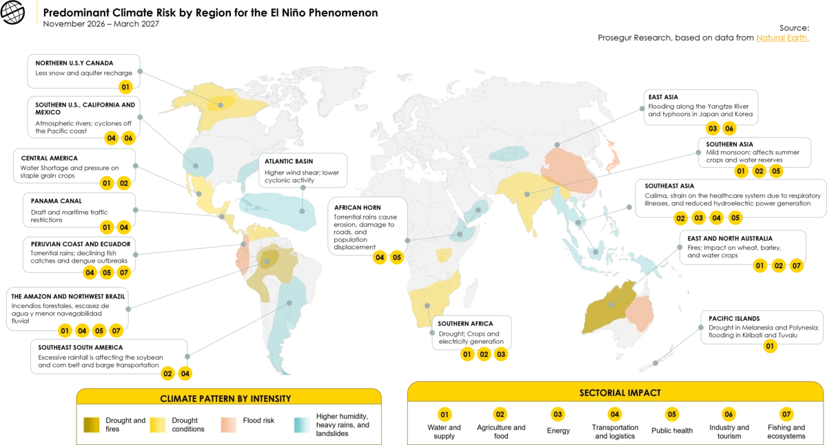
Where might the main impacts of El Niño be concentrated, and which regions are most at risk? Although it is a global climate phenomenon, its effects are not distributed evenly: while some areas may experience droughts and extreme temperatures, others face a higher risk of heavy rainfall, flooding, or disruptions to their ecosystems.
In the first part of this analysis, we examined how El Niño can trigger a domino effect on the global economy, affecting energy, agriculture, transportation, and supply chains. In this second installment, we focus on the geography of risk: the most exposed regions, the climate events that could affect them, and their potential consequences for economic activity and strategic infrastructure.
The following map provides an overview of the main areas of exposure during the 2026–2027 period and helps identify how a single phenomenon can generate very different risks depending on the region.
You can access the map via the link.
-
Self-protection: a culture that goes beyond the emergency backpack
November 10, 2026
-
El Niño 2026–2027: The Global Map of Climate Risks
November 5, 2026